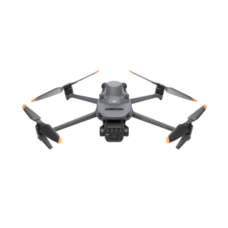
The DJI Mavic 3 Enterprise is a small drone that redefines industry standards. With a mechanical shutter, a 56× zoom camera, and an RTK module for centimeter-level accuracy, the Mavic 3E takes mapping and mission efficiency to new heights. Additionally, there is a version with a thermal camera for firefighting missions, search and rescue, inspections, and night operations.
The DJI Mavic 3 Enterprise is a small drone that redefines industry standards. With a mechanical shutter, a 56× zoom camera, and an RTK module for centimeter-level accuracy, the Mavic 3E takes mapping and mission efficiency to new heights. Additionally, there is a version with a thermal camera for firefighting missions, search and rescue, inspections, and night operations.
The Mavic 3 Enterprise combines a sleek and compact design that makes it easy to transport with the ability to deploy quickly in any situation. Its versatility makes it the ideal choice for both novice pilots and experienced professionals, being especially designed to carry out extensive missions efficiently.
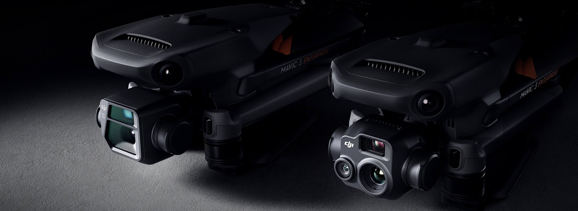
DJI Mavic 3E |
DJI Mavic 3T |
Wide-angle4/3 CMOS, 20 megapixels, mechanical shutter |
Wide-angleEquivalent focal length: 24 mm, 48 megapixels |
TelecameraEquivalent focal length: 162 mm, 12 megapixels, 56x hybrid zoom |
TelecameraEquivalent focal length: 162 mm, 12 megapixels, 56x hybrid zoom |
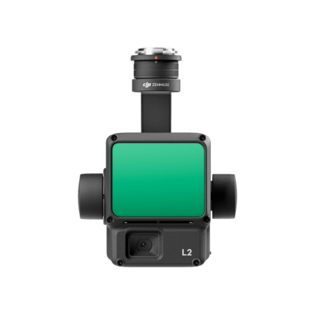
ThermalDFOV: 61º, equivalent focal length: 40 mm, 640x512 resolution |
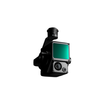
The Mavic 3E's wide-angle camera with a 4/3 CMOS 20 MP sensor features a mechanical shutter to prevent motion distortion and enables fast shooting with intervals of 0.7 seconds. Perform mapping missions with extraordinary efficiency without the need for ground control points.
The Mavic 3E's wide-angle camera features large 3.3 μm pixels to offer significantly improved performance in low-light environments, along with the intelligent low-light mode.
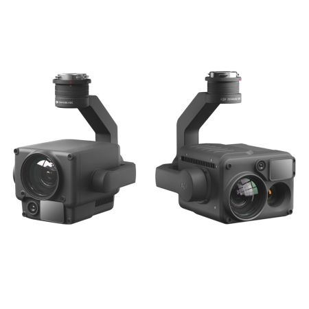
Both the Mavic 3E and Mavic 3T are equipped with a 12 MP zoom camera, supporting up to 56× hybrid zoom, allowing you to view essential details from a distance.
The Mavic 3T's thermal camera has a resolution of 640×512 and supports spot and area temperature measurement, high-temperature alerts, color palettes, and isotherms to help you find your targets and make quick decisions.
The Mavic 3T's thermal and zoom cameras enable continuous 28× zoom, side by side, for easy comparison.
45 minutes of flight time allow you to cover a large area in each mission, up to 2 square kilometers in a single flight.
Quickly charge the batteries with the 100 W charging hub or charge the drone directly with 88 W fast charging.
O3 Enterprise transmission with a cubic antenna enables more stable connections in a wide range of complex environments.
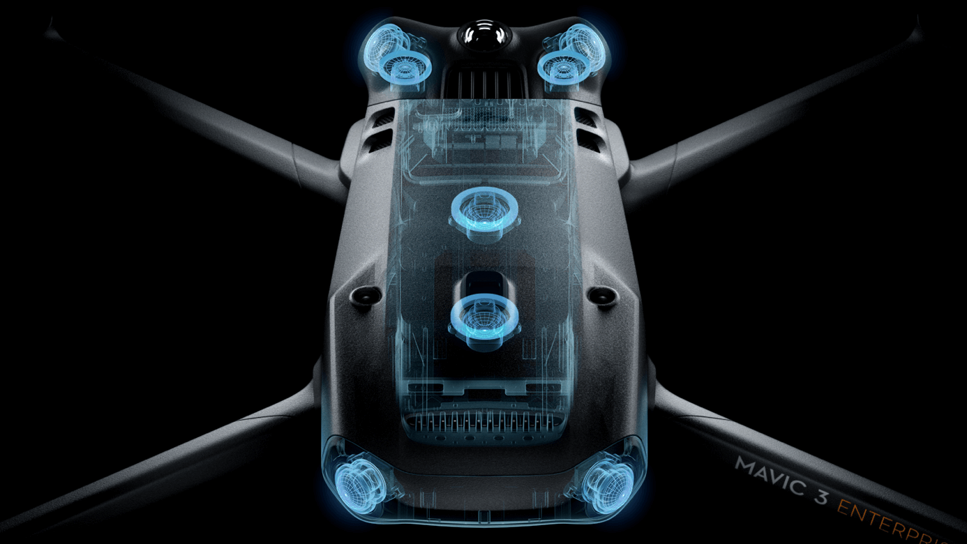
Equipped with wide-angle sensors on all sides, it provides an omnidirectional obstacle avoidance system with no blind spots. Adjust proximity alerts and braking distance according to mission requirements.
Advanced RPO automatically plans the optimal return route to save energy, time, and concerns. APAS 5.0 allows automatic rerouting around obstacles, giving you more peace of mind during flight.
Real-time terrain following |
Automatically adjusts altitude when mapping areas with varying elevations, without needing to import external elevation data, thanks to the Mavic 3E's omnidirectional sensing. |
Smart Oblique Capture |
Enhance your oblique photography mission efficiency with Smart Oblique Capture. During flight, the gimbal automatically rotates in three directions: front, middle, and rear. Two flight routes can collect all photos at the necessary angles for high-precision 3D modeling. |
Live mission recording |
Record mission actions, such as aircraft movement, gimbal orientation, photo recording, and zoom level, to create sample mission files for future automated flights. |
Corridor Mission Planning |
Create automated flight missions for highways, rivers, pipelines, etc., with Corridor Mission Planning. Simply draw a line on the map, and this feature divides the area into mappable segments for direct surveying. |
Request more information about the DJI Mavic 3 Enterprise and get yours now.
You might also like