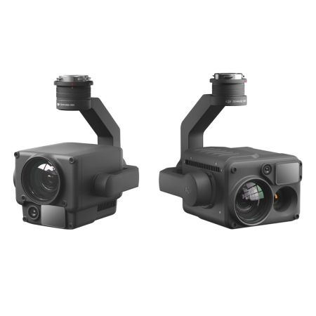
Experience instant clarity and superior precision in aerial surveying with the Zenmuse L1, an advanced solution that combines LiDAR and RGB to deliver exceptional results.
The Zenmuse L1 incorporates a Livox LiDAR module, a high-precision IMU, and a 1-inch CMOS sensor camera on a 3-axis gimbal. This integration of advanced technologies ensures smooth and precise data capture in any scenario.
Whether for surveying, mapping, or any application requiring detailed 3D data, the Zenmuse L1 stands out for its ability to deliver clear, instant results with superior precision. Discover a new era in aerial data collection with this advanced and versatile solution.

Discover uncompromised digitization with the Zenmuse L1, a solution that redefines efficiency, precision, and availability in aerial data collection.
 |
 |
 |
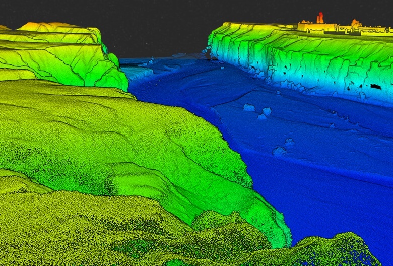
Exceptional EfficiencyGenerate real-time, colorized point cloud models or acquire 2 km² of point cloud data in a single flight. This is made possible by the Livox frame LiDAR module, offering a 70° field of view and a visible light camera with a 1-inch sensor. Exceptional efficiency becomes the norm with this advanced solution. |
Unmatched PrecisionRender centimeter-level reconstructions thanks to the high-precision IMU, a vision sensor for precise positioning, and integrated GNSS data. The Zenmuse L1 ensures reliable and detailed results for your surveying tasks. |
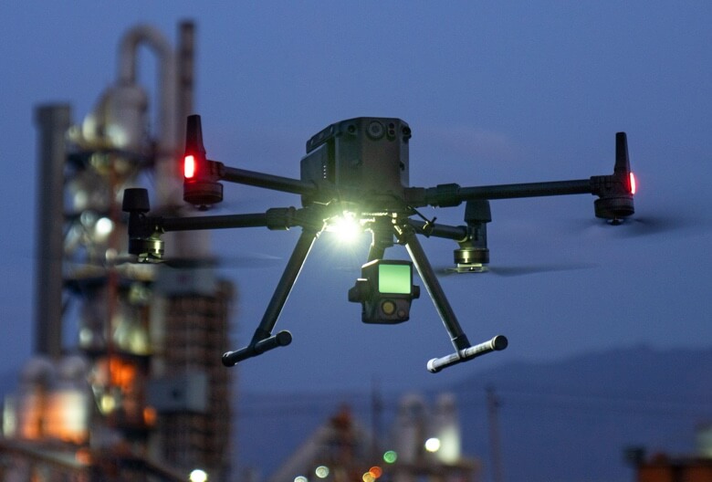
Ready When You AreWith an IP54 protection rating, the Zenmuse L1 operates seamlessly in rainy or foggy environments. Additionally, the active scanning method of the LiDAR module allows for night flights, providing total flexibility in your operations. |
Experience an unparalleled data visualization during flight with the Zenmuse L1, featuring an advanced Livox LiDAR module, a high-quality RGB camera, and a high-precision IMU.
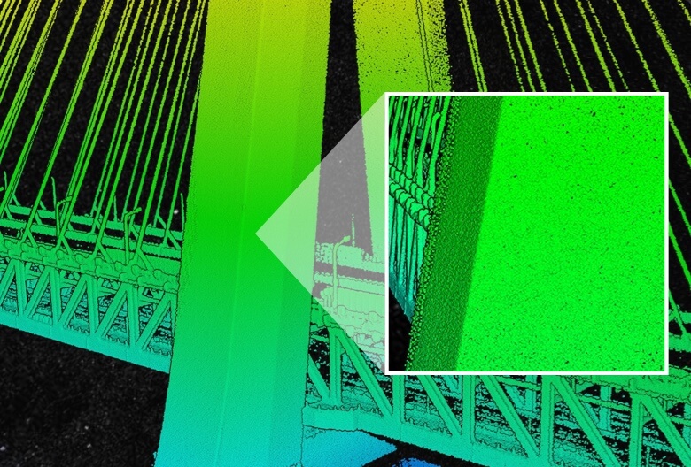
Enjoy a live point cloud view during the flight. Real-time point clouds provide immediate on-site information, allowing operators to make critical decisions faster. Additionally, you can verify job quality in the field by checking the point cloud data right after each flight.
DJI Terra integrates IMU and GNSS data for point cloud and visible light calculations. Additionally, it performs POS data calculations, enabling you to generate reconstructed models and accurate reports effortlessly. The entire post-processing workflow is streamlined in a single application, providing a comprehensive solution for your aerial surveying needs.
With the Zenmuse L1 and DJI Terra, data visualization and processing integrate seamlessly, taking data capture and analysis to new heights of efficiency and precision.
Topographic Mapping |
Generate topographic maps with precise digital elevation models. |
Construction and Surveying |
Manage the entire project lifecycle with high-precision point clouds and 3D models. |
Emergency Response |
Gather critical real-time information, anytime, using color point clouds. |
Law Enforcement |
Gain situational awareness and forensic information in real time for informed decision-making. |
Energy and Infrastructure |
Model complex or dispersed structures for efficient and safe management. |
Agriculture and Forestry Management |
Obtain insights into vegetation density, surface area, population volume, canopy size, and other growth trends. |
You might also like