
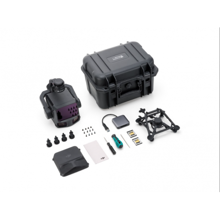
The DJI Zenmuse L3 is a high-end aerial LiDAR solution designed for professional surveying applications. It delivers centimeter-level accuracy, an extended detection range, and superior operational efficiency, allowing large-scale mapping with speed and reliability from the air.
The DJI Zenmuse L3 is a high-end aerial LiDAR solution designed for professional surveying applications. It delivers centimeter-level accuracy, an extended detection range, and superior operational efficiency, allowing large-scale mapping with speed and reliability from the air.
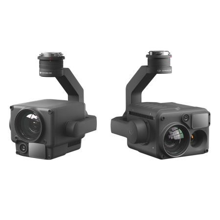
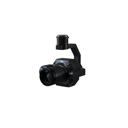
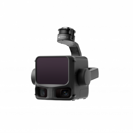
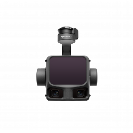
The Zenmuse L3 integrates a next-generation LiDAR sensor, a system of dual 100 MP RGB cameras, a high-precision IMU, and a 3-axis stabilized gimbal into a single device.
This combination of sensors allows simultaneous capture of dense LiDAR point clouds and ultra-high-resolution aerial imagery on every flight, ensuring that every terrain detail is documented both geometrically and visually. The factory-calibrated IMU, combined with the drone’s RTK synchronization, ensures that all data is georeferenced with centimeter-level precision, reducing the need for ground control points to achieve accurate results.
The L3 offers three LiDAR scanning modes (repetitive, non-repetitive, and an additional advanced mode) to adapt to different survey missions. Its frame LiDAR sensor can emit laser pulses at extremely high rates, generating millions of points per second and recording multiple returns per pulse (up to 12 echoes captured).
As a result, it produces exceptionally dense point clouds capable of penetrating dense vegetation and capturing the terrain beneath trees with remarkable clarity. This translates into more complete digital terrain models, even in forests or hard-to-reach areas, overcoming the limitations of traditional photogrammetry in heavily vegetated environments.
Even when operating at higher flight altitudes, the Zenmuse L3 maintains topographic accuracy within 1–3 cm (approx. 2 cm vertical and 3 cm horizontal error). These accuracy levels meet detailed mapping standards (scale 1:1000 or better) without requiring multiple passes or low-altitude flights.
Additionally, the L3’s LiDAR provides an extended detection range: it can detect objects about 300 m away even on low-reflectivity surfaces under bright light, and up to 500 m or more in low-light conditions. This allows large areas to be covered from higher altitudes or with fewer flights, without compromising point density or measurement fidelity.
The high sensor power and wide field of view provided by the dual camera enable the mapping of vast terrain areas with fewer flights. Under ideal conditions, a single mission with the Zenmuse L3 can cover several square kilometers, significantly reducing data capture time and, consequently, operational costs for surveying teams.
Thanks to the high point density achieved, there is no need for low-altitude flights or tightly spaced flight lines, optimizing drone use and maximizing efficiency in every project. In short, it delivers comprehensive geospatial coverage with minimal fieldwork, increasing productivity compared to traditional methods.
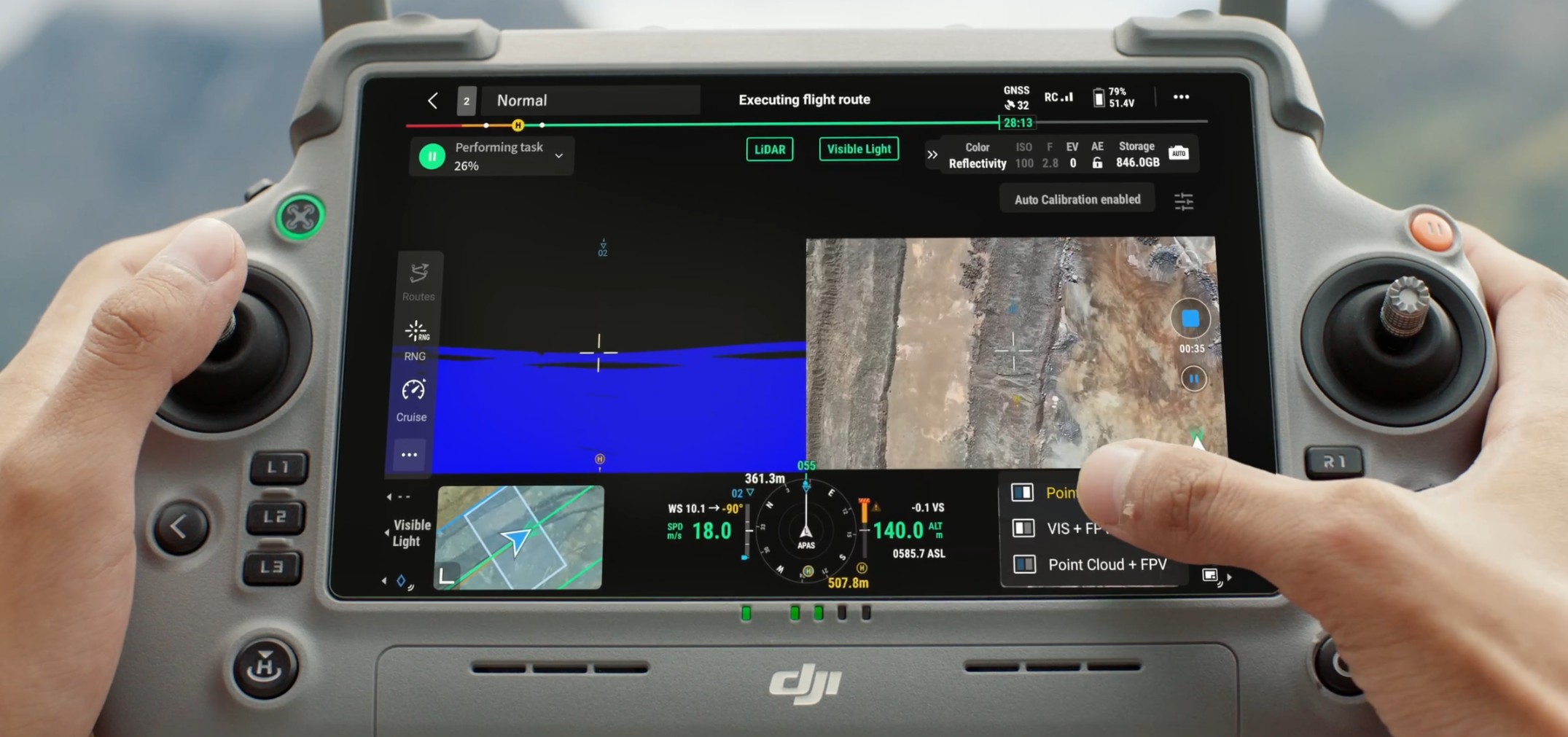
The Zenmuse L3 is part of the DJI Enterprise ecosystem, streamlining the entire workflow from data capture to post-processing. After flight, LiDAR data and RGB imagery are processed in DJI Terra to generate georeferenced point clouds and high-accuracy 3D models. Then, using DJI Modify, users can intuitively edit and refine these 3D models, completing an integrated solution where aerial surveying becomes an efficient, end-to-end process.
Furthermore, the L3 is fully compatible with the DJI Matrice 400 series, leveraging the high-performance RTK flight platform of this drone and integrating seamlessly into professional operations.
Altogether, the Zenmuse L3 provides surveyors and geomatics professionals with a powerful, reliable tool that optimizes data capture, processing, and delivery of highly accurate topographic results in less time.
You might also like