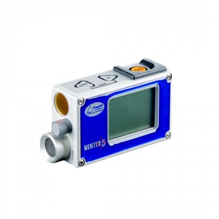
The next generation of handheld laser rangefinders from Haglöf Sweden.
Laser rangefinder — 3-axis inclination sensor — Bluetooth — Compass — GPS — USB — SSD drive.
The next generation of handheld laser rangefinders from Haglöf Sweden.
Laser rangefinder — 3-axis inclination sensor — Bluetooth — Compass — GPS — USB — SSD drive.
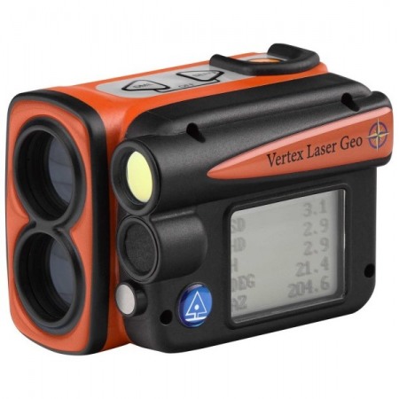
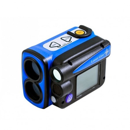
Get ready for the future with the Laser Geo 2, a state-of-the-art, high-precision, long-range laser!
Thanks to its advanced multi-sensor technology and full programming capabilities, the Laser Geo 2 offers endless possibilities and versatile features.
The unique capabilities of the Laser Geo 2 allow you to measure, map, process, and store field and forestry data in ways you never imagined possible:
The Laser Geo 2 includes an advanced platform that allows you to download and install new applications tailored to your needs. Additionally, we offer the option to create custom applications based on your specific preferences.
When you receive the instrument, the Laser Geo 2 includes a pre-installed standard application, offering the same functions as its predecessor, the Laser Geo, along with improvements and new features such as Remote Diameter functionality.

Explore all the measurement capabilities with the Laser Geo 2, equipped with the standard application. Whether measuring heights, distances, mapping, or processing forestry and field data, the Laser Geo 2 turns the impossible into reality.
Transform data collection and processing with the Laser Geo 2, the ultimate tool for precision and efficiency!
| Size | 93x63x72mm / 3.7×2.5×2.8” |
| Weight | 243 g / 8.6oz. |
| Battery and Consumption | Rechargeable Li-Ion 3.7V battery, built-in, approx. 2000 measurements. Max charging time 3.5h. Mini USB B charger, 110/220AC/5VDC; car charger adapter 12VDC. Mini USB B male/USB A male cable, 0.5m. Max consumption 0.9W. |
| Communication | IR, USB 2.0/SSD. Dual-mode Bluetooth BR/EDR. Low-energy Bluetooth V4.2 (LE) and classic connectivity. Spp (serial profile), PIN code 1234. |
| Temperature | -20° to +45° C / -4°F to 113°F. |
| Height | 0-999 m/ft. Height resolution: 0.1 m/ft. |
| Angle | -90° – 90°. Unit: Degrees 360⁰, Grads 400⁰, and %. Resolution: 0.1⁰. Accuracy: 0.1⁰ typical. |
| LASER | Distance: 46cm / 1.5ft – 700m / 2000ft depending on the target. Accuracy: 4cm / 0.1ft typical. Resolution: 0.1m/ft (0.01m/0.1ft in DME mode). |
| Area | 0 < area < 5000m² or 0.5ha < area < 10000ha. 0 < area < 20000ft² or 0.5acre < area < 10000acre. |
| Remote Diameter | Sight range: 0-46 positions. Max diameter: 47” at 39ft / 98cm at 10m. Resolution: 0.1” / 0.1cm. Accuracy: 0.5” at 39ft / 1.2cm at 10m. |
| GPS | High-sensitivity 33-channel receiver. Compatible with GPS, Glonass, Galileo, QZSS. Real-time correction with SBAS (EGNOS, WAAS, MSAS, GAGAN). Accuracy up to 2.5m / 8.19ft in open terrain. Satellite position prediction up to 3 days. Compatible with global systems GPS (USA), GLONASS (Russia), Galileo (EU), QZSS (Japan). Satellite-based augmentation systems: WAAS (USA), EGNOS (EU), GAGAN (India), MSAS (Japan). Auto-generated orbit prediction (faster TTFF, up to 3 days), integrated interference suppression. Accuracy: Automatic position 2.5m CEP (circular error probable) (50% 24 hr static, -130dBm). Speed 0.1m/s (50% @ 30m/s). |
| Compass | Azimuth compass 0-360˚, resolution 0.1˚, accuracy <1.5 RSME˚. |
| Classification | MIL-STD-810E. Frame material: glass-reinforced polycarbonate, IP67, NEMA6, Laser Class 1, 7mm (FDA, CFR21), Class 1m (IEC 60825-1:2001). |
| Viewfinder | 1x magnification sight and (HUD) front viewer. |
| Display | External LCD graphic display 100x60 pixels. Internal (HUD) front viewer. |
| Data Format | NMEA or ASCII. IR, Bluetooth. |
| File Format | CSV and KML (Google Earth). |
| Memory | 2000 data sets, non-volatile. |
| Other Information | Adapter and monopod, 4 pieces (33-140cm). Aluminum carrying/storage case. See user manual for details. |
You might also like