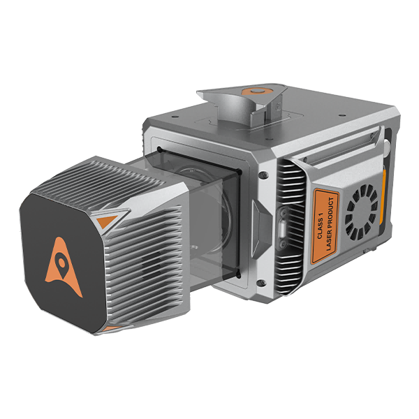

The AlphaUni 20 is a premium-class mobile LiDAR system, designed for maximum versatility and cost-efficiency.
The AlphaUni 20 is a premium-class mobile LiDAR system, designed for maximum versatility and cost-efficiency.
Its advanced technology delivers high-density and high-precision point clouds, ideal for vehicle-mounted, UAV, or backpack-based applications in narrow environments.
| High absolute accuracy | 2–5 cm, 5 mm repeatability |
| Extended range | Up to 1450 m with 2M pts/s density |
| Vegetation penetration | Up to 16 returns per pulse, ideal for DEM/DSM |
| Lightweight and rugged design | Only 2.82 kg (3.12 kg with C5 camera); IP64 rated |
| Multi-platform versatility | Fast integration with manned/unmanned UAVs, vehicles, backpacks, etc. |
| Optimized workflow | Quick Alphaport connection, real-time control via SmartGo, processing with CoPre/CoProcess |
| High-frequency navigation | Full GNSS + 600 Hz IMU |
| Parameter | Detail |
|---|---|
| Maximum range | 1450 m |
| Scan rate | 2 M pts/s |
| Returns | Up to 16 |
| Absolute accuracy | 2–5 cm; 5 mm repeatability |
| GNSS + IMU | Full GNSS + 600 Hz |
| Weight | 2.82 kg (3.12 kg with camera) |
| Field of view | 360° |
| IP protection | IP64 |
| Operating temperature | –20 °C to +50 °C (rtkgpssurveyequipment.com, canalgeomatics.com) |
You might also like


