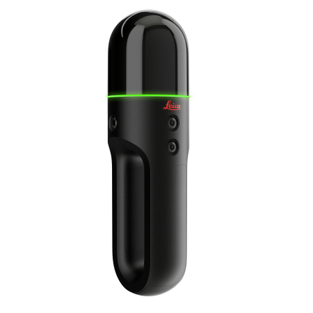

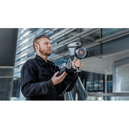
The CHCNAV RS10 combines SLAM and high-precision RTK positioning in a single device. It features an HD camera, a 16- or 32-line LiDAR scanner, and an IMU.
This mobile laser scanner enables fast data capture with absolute coordinates in both indoor and outdoor environments.
Up to 5 cm accuracy without GNSS and a simple workflow with cloud-based processing.
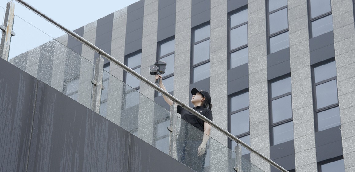
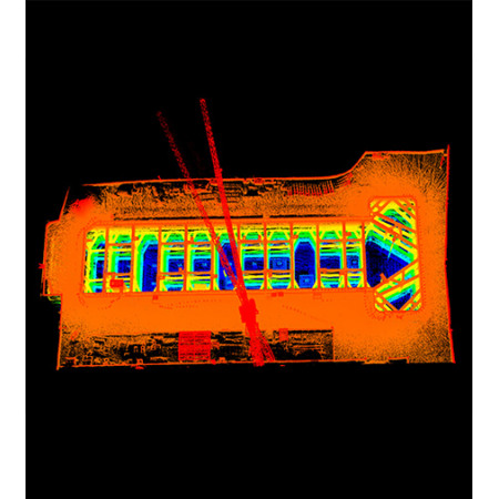
The CHCNAV RS10 is a portable 3D scanning solution that merges GNSS RTK, laser scanning, and visual SLAM technologies in one device, designed for surveying and reality capture in both indoor and outdoor settings. Its unique combination of sensors and algorithms allows real-time georeferenced point clouds with up to 5 cm absolute accuracy, even in areas without GNSS signal.
| GNSS RTK + SLAM | Combines RTK technology, laser scanner, and visual SLAM to achieve 5 cm absolute accuracy. |
| Real-time mapping | Generates georeferenced point clouds in real time directly in the field. |
| High precision | Achieves 1 cm relative accuracy thanks to integrated GNSS and LiDAR technologies. |
| Hot-swappable battery | 60 minutes per battery, hot-swappable for uninterrupted operation. |
The RS10 represents a paradigm shift in fieldwork. By integrating high-precision GNSS with visual SLAM and LiDAR scanning, this device eliminates the traditional barriers between outdoor surveying and indoor scanning. No need to switch devices or perform post-alignment—RS10 lets you work seamlessly under one coordinate system, whether in open spaces or confined or urban areas with limited GNSS signal.
This flexibility is made possible by proprietary technologies like SFix, which enables precise RTK coordinates even without satellite visibility, and Vi-LiDAR, which delivers real-time non-contact measurements using images and point clouds. These functions make the RS10 exceptionally valuable for demanding projects such as as-built surveys, BIM scans, infrastructure inspection, mining, tunnels, or forestry mapping.
One of the RS10’s greatest strengths is its ability to combine high-precision GNSS RTK with visual and laser SLAM scanning, providing 3D data with absolute accuracy of up to 5 cm even in challenging environments. This technology fusion removes the limitations of traditional mobile scanning systems: regardless of satellite coverage, RS10 guarantees consistent, accurate, and ready-to-use results.
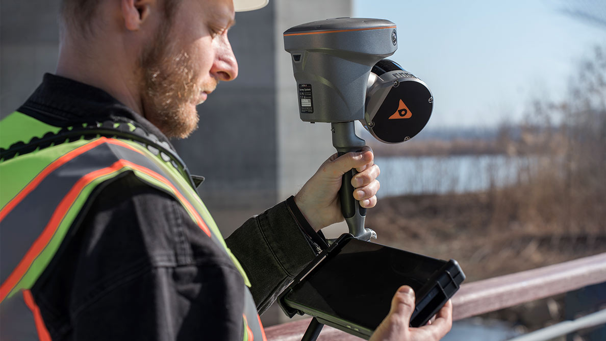
With its fourth-generation GNSS antenna, up to 32-line LiDAR scanner, and three HD cameras, the RS10 delivers 1 cm relative accuracy in both large open areas and complex indoor spaces, tunnels, or urban canyons. It is an ideal tool for surveyors, engineers, and BIM professionals needing reliable data from the start.
Furthermore, its ability to generate real-time georeferenced point clouds allows users to visualize and validate data immediately on-site, minimizing errors, avoiding rework, and enabling quick decision-making.
On top of that, the RS10 is built for long workdays. Its hot-swappable lithium battery provides up to 60 minutes per unit, allowing seamless operation without shutdowns—perfect for high-demand environments where every minute counts.
The CHCNAV RS10 is not just a portable scanner—it’s a full solution designed for professionals who require precision, speed, and flexibility on every project. From capture to processing, everything is streamlined to support professional work without compromising quality.
Thanks to CHCNAV’s software ecosystem—SmartGo, CoProcess, and LandStar—the workflow is smooth, intuitive, and powerful. You can view point clouds in real time, automatically generate drawings, or extract 3D models quickly. All this without relying on external software, reducing time and potential errors.
Its lightweight and rugged design (IP64), capability to scan up to 13,000 m² in a single pass, and adaptability to both indoor and outdoor environments make it an essential tool for surveying, BIM, mining, powerline inspection, forestry mapping, or underground studies.
If you're looking for a portable solution that combines SLAM scanning, GNSS RTK, and real-time visualization, the RS10 is made for you.
You might also like