LOGiCAT VU
Management and monitoring system Leica LOGiCAT VU
Leica LOGiCAT VU
Analyze data to reduce utility breakages
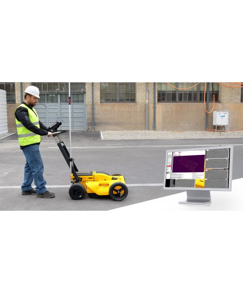
By implementing Leica Digicat cable locators, utility breakages are drastically reduced. Now, with the introduction of Leica LOGiCAT VU software, it is possible to centrally manage and monitor cable locators.
Data analysis helps fleet managers improve the use and efficiency of cable locators during excavation, enhances worksite safety initiatives, and supports product familiarization training and operator behavior.
What is LOGiCAT VU?
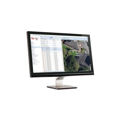
Leica LOGiCAT VU is a management and monitoring system to analyze data from cable locators.
Cable locators are used to identify the location of underground utilities. The data allows instruments to record GPS coordinates along with the data recorded by the instruments.
Leica LOGiCAT VU helps plant, fleet, or site managers evaluate and analyze data from one or more cable locators.
The system provides fleet managers with a "view" of how the survey was conducted and whether it was done according to best practices. Locator positions can be mapped and presented through Google Maps, highlighting the survey route.
LOGiCAT VU Benefits
- More information on whether best practices have been adopted. If only the cable locator is used, up to 45-50% of inactive cables, which could cause fatal injury, may not be detected. The fleet manager can evaluate the data from Leica LOGiCAT VU and see if the operator has thoroughly investigated the site — and how — in all modes and with the correct accessories, ensuring best practices are followed.
- Data visualization on satellite images to aid interpretation. GPS allows the cable locator to record coordinates along with usage data. Leica LOGiCAT VU displays field data overlaid on maps and digital images, indicating where the operator has surveyed to facilitate subsequent evaluation. Clarity for post-incident evaluation.
- Clarity for post-incident evaluation. In case a utility is broken, an incident report can be easily produced and provide a clear and comprehensive view of the instrument usage that led to the incident. The survey quality is color-coded in the report: red (poor) and green (good).
- Data export to GIS and BIM systems. Instrument data can be exported to third-party GIS and BIM software, enhancing knowledge of underground utilities for future excavation activities.
Leica LOGiCAT VU – Software Tool Package
- LOGiCAT VU Mobile Application
Provides quick and easy data transfer from the locator from the field to the office.
- One-step data transfer from the site to the office
- Data transfer using Bluetooth® wireless technology
- Available for smartphones and tablets
- Free download and use
- Can be installed on multiple devices at no additional cost
- LOGiCAT VU Windows-based Software
LOGiCAT VU software is a Windows-based system providing a complete solution for creating, maintaining, and monitoring your DIGICAT cable locator fleet.
- Complete solution for managing your DIGICAT fleet
- Create a database of fleet activity
- Evaluate operational quality and operator performance
- Reports on best practice adherence
- Provides post-incident analysis reports
- Import locator files, LOGiCAT VU app, email, or network server
- Use common map formats, such as GPX and KML, directly in Google Maps
- Export to GIS resource management systems
- Windows-based system for free download and use
Start today to reduce utility impacts; download the LOGiCAT VU software and app.
You might also like