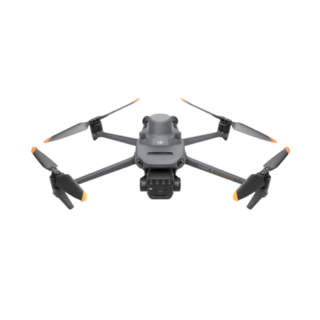
The DJI Matrice 3D drone has been designed to perform autonomous mapping and surveying missions.
The DJI Matrice 3D drone has been designed to perform autonomous mapping and surveying missions.
The new DJI Matrice 3D drone is specifically designed for the DJI Dock 2.
Equipped with a telephoto camera and a wide-angle camera with a mechanical shutter, covering high-precision mapping tasks at a 1:1500 scale.
This drone has been designed to meet very high operational requirements and features an integrated RTK antenna and omnidirectional obstacle detection, which greatly enhances its success in each autonomous flight task.
It offers a flight time of 50 minutes, an operational range of 10 kilometers, and an IP54 protection rating for wind and dust. It can be recharged for 400 cycles.
The DJI Matrice 3D is designed for autonomous mapping and surveying missions.
It features a telephoto camera and a camera with the following characteristics:

You might also like