What is a total station and what is it for?

In this post, we explain everything you need to know about total stations in surveying: what they are, types of total stations, and much more.
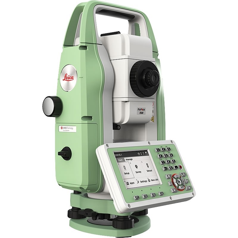
A total station is a theodolite that includes an integrated distance meter, capable of measuring angles and distances simultaneously.
Additionally, they have other features such as an alphanumeric LCD screen, warning LEDs, independent sunlight illumination, a calculator, and a tracker.
They are highly precise instruments and valuable in the market, though it's possible to purchase cheap second-hand total stations in our online store of surveying equipment.
What is the difference between a theodolite and a total station?
A theodolite measures only horizontal and vertical angles. Sometimes they are also called tachymeters, as by measuring angles to a graduated staff, it is possible to calculate distance through geometric/trigonometric calculation. A theodolite can be mechanical or electronic. The total station can measure angles and distances electronically and process the data trigonometrically to provide us with spatial position coordinates at minimum.
Currently, all electronic total stations have an electronic optical distance meter (EDM) and an electronic angle meter, allowing them to read the barcodes of the scales on the horizontal and vertical circles, displaying angle and distance values digitally. The horizontal distance, height difference, and coordinates are automatically calculated with a total station.
Our total stations are used to determine the position and height of a point, or simply its position.
What is a total station used for?
Plumbing from a height
Plumbing from a height or over a point on the ground, as well as checking the vertical alignment of a structure, can be done precisely with a single side of the telescope, as long as it describes a completely vertical plane when rotated.
This type of work requires your total station to be well leveled and to reduce the influence of vertical axis tilt.
Surveys
When plotting the plan of a building, the position and height of a point are determined by measuring angles and distances. The surveying instrument is placed on a point referenced to a local coordinate system. For orientation purposes, a second easily distinguishable point is chosen after sighting it with the horizontal circle set to zero.
Staking out
To align a building, it is useful to extend the sides beyond the excavation limits to determine the profile boundaries on which stakes are placed.
During the construction process, ropes or cables can be tied to the stakes to indicate the positions where the walls should be.
Automatic target recognition
Used total stations from Leica Geosystems feature an ATR (Automatic Target Recognition) system. This system allows for quick and easy target recognition.
Thanks to this technology, measurements can be made automatically with the help of a computer. Practical applications of this feature include precise control of construction machinery guidance.
Measuring inaccessible distances (TCR total stations)
Most second-hand total stations from Leica Geosystems have a laser distance meter that does not require a prism. This technology is very useful when measuring boundaries, placing conduits, or measuring along gullies or fences.
Other applications
Total stations have many other applications, such as road and corridor surveys, land surveys, infrastructure surveys, volumetric surveys, power line inspections, accident or crime scene investigations... They are versatile equipment used in many different sectors, not just in classic construction surveying.
How to use a total station?
- Gather all your equipment. Check that you have everything you need before going to work: a tripod for your total station, a leveling base, stakes, nails...
- Transport your equipment safely. Total stations are valuable equipment susceptible to falls and strong impacts. Always transport it in its original case. Avoid mistakes like carrying the station mounted on the tripod on your shoulders or using the station case as a seat. Don't sit on it!
- Establish a reference point. Mark a control point with paint, a stake, or a nail.
- Set up and adjust the tripod. Adjust the legs of your surveying tripod by raising and moving the instrument until you align and level the tripod center with the reference point.
- Mount and center the total station. Choose a point with good visibility towards as many points as possible.
- Make the final leveling adjustments. Ensure the tripod and station are leveled for precise work. Verify the surveying point to confirm it is perfectly leveled and correct it if necessary.
You are now ready to work with your total station.
What types of total stations are there?
There are different types of total stations. At Topotienda, we have all kinds of stations, both new and second-hand:
Manual total stations
Surveying equipment primarily used for medium and high precision measurements. They are the cheapest total stations, allowing for a quick return on investment.
Robotic total stations
These are surveying equipment with great functionality, as they search for the target on their own, scanning until they find it.
They work with a manual controller that operates the total station from the location of the prism, reducing the personnel needed for its use to one person.
Surveying multi-station
These are the total stations with the best features as they include laser-scanner and imaging technology. An instrument for all surveying tasks, taking sensor fusion to the next level.
How much does a total station cost?
The price of a total station from Leica Geosystems can vary greatly, depending on the software, station extras, model, range...
On the other hand, the price of a second-hand total station usually ranges between 2,500€ and 30,000€ (there are more expensive and cheaper ones) depending on the features it was manufactured and purchased with.
Advantages of buying a total station at Topotienda
The team behind Topotienda is the group of professionals from Global Geosystems. Global Geosystems is a 360º team of professionals in surveying, construction, engineering, architecture, and many other fields. It is not just a group of salespeople but a qualified team of technical advisors who know the details of Leica Geosystems products and the needs of users better than anyone, with superior expertise provided by their intensive training and years of experience selling surveying instruments.
Additionally, the technical support team at Global Geosystems accompanies the customer with top-quality service and useful materials such as guides and training videos on the various Leica products.
We have three SAT in the national territory (Santiago de Compostela, A Coruña, and Bilbao), making us the distributor with the most national presence in the surveying market. Of course, we also have the CEM calibration certificate.
Renting a surveying total station
At Topotienda, we have the latest technologies and the most modern and advanced surveying instruments. We not only rent total stations but also surveying GPS or laser scanner equipment (terrestrial and mobile), all from Leica Geosystems, reviewed and calibrated to the millimeter, configured according to your needs.
However, we know that all our customers' needs go beyond our catalog, and we want to adapt to their situation. We offer flexible surveying equipment rentals, with purchase options and also through renting.


