
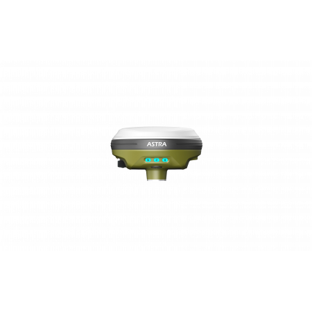
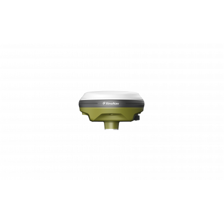
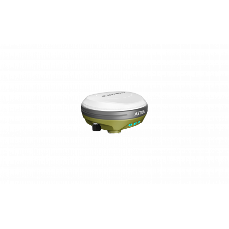
The RinoNav ASTRA is a robust and portable professional GNSS receiver designed to operate both as a base station and as a rover. Its compact design, integrated UHF modem, and ability to work with tilts up to 60° make it a versatile solution for staking, field measurements, and challenging environments.
The RinoNav ASTRA is a robust and portable professional GNSS receiver designed to operate both as a base station and as a rover. Its compact design, integrated UHF modem, and ability to work with tilts up to 60° make it a versatile solution for staking, field measurements, and challenging environments.
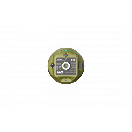
With more than 1408 GNSS tracking channels, the ASTRA supports multiple constellations and frequencies —GPS, BDS, GLONASS, GALILEO, QZSS, and SBAS— ensuring wide coverage and reliable performance even in complex environments. This receiver integrates an internal UHF Tx/Rx modem, allowing it to operate as a base or rover without additional hardware. Its dynamic tilt survey up to 60° with a MEMS sensor enables measurements without keeping the pole perfectly vertical, making work easier on slopes, corners, or hard-to-reach areas. Moreover, its lightweight, compact, and durable design (approximately 550 g, diameter Ø120 mm × height ~72.5 mm, IP67 protection) makes it easy to handle during fieldwork.
| Operating system | Linux |
| Internal memory | 16 GB |
| Connectivity | Bluetooth 5.0 + EDR, BLE; Wi-Fi 802.11 b/g/n/ac |
| GNSS – channels | 1408 channels (optional up to 2050) |
| Cold start | < 30 s |
| Hot start | < 5 s |
| Update rate | 20 Hz |
| RTK accuracy | H: 8 mm + 1 ppm (RMS) V: 15 mm + 1 ppm (RMS) |
| Tilt survey accuracy | 10 mm + 0.7 mm/° tilt; < 25 mm at 30° tilt |
| Dimensions / Weight | Ø120 mm × H ~72.5 mm; approx. 550 g |
| Operating temperature | -30 °C to +60 °C |
| Protection | IP67 dust and water proof |
| Internal radio (UHF Tx/Rx) | Transmission power: 1 W Typical range: 3–5 km (depending on terrain/obstacles) |
Ideal for professionals in surveying, civil engineering, geodesy, land measurement, construction, mining, and site control who require a versatile and precise GNSS receiver ready for real-world field conditions.


