Leica Pegasus: Two Mobile Sensor Platform
Create new opportunities with your vehicle-independent mobile mapping solution.
Leica Pegasus: Two Mobile Sensor Platform
Create new opportunities with your vehicle-independent mobile mapping solution.
The mobile mapping solution Leica Pegasus:Two uses a laser scanner (or several scanners) in combination with GNSS receivers, Inertial Measurement Unit (IMU), and a Distance Measurement Instrument (DMI) on a mobile platform (vehicle) to acquire precise and accurate spatial data.
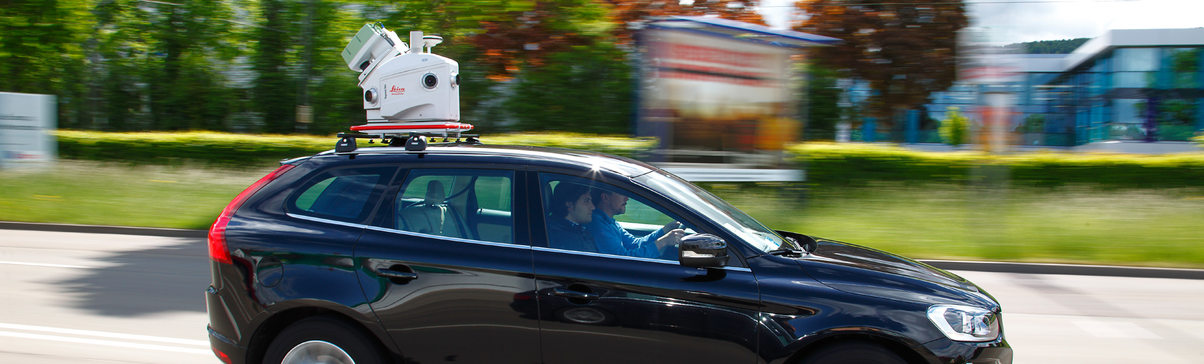
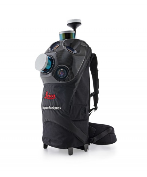
Leica Pegasus:Two is a complete mobile mapping solution from hardware to Leica Geosystems’ object extraction. The Leica Pegasus:Two solution provides an integrated hardware platform that includes cameras and lidar profilers with an external trigger and synchronization output for additional sensors. Simply fly in, collect, then fly out—no dedicated, modified vehicles are required—batteries included, measure the unlimited.
The Leica Pegasus:Two captures calibrated images and point cloud data together—ensuring no object is forgotten. Capturing the full 360° spherical view and lidar together means you'll never forget an object or return to the project site. Leica Pegasus: Two offers an optional rear road camera for pavement analysis that offers options to grow your business—collect once, sell twice.
Enabled by a complete software workflow including data acquisition, calibration, post-processing enabled by Novatel, object extraction, and a configurable GIS-enabled layered storage—the Leica Pegasus:Two is your simple and easy answer. A hardware light sensor ensures the operator that all images are usable after post-processing. Capture to extract—your only necessary tool.
You might also like