

Create your custom monitoring site. Analyze and visualize monitoring data from anywhere.
Leica GeoMos Now! is a real-time monitoring and analysis solution for critical infrastructure and construction projects. With GeoMos Now!, you can quickly detect any changes or movements in your structures and take preventive measures.
Leica GeoMoS Now! is a web application that allows full access to monitoring data through any connected device at any time. Data is instantly available and users do not need any prior knowledge of web development. Easy-to-use, intuitive configuration tools simplify website creation. Manage, analyze, and distribute key information later with a simple setup. The use of real-time data, early problem detection, and quick reaction times can prevent potential problems before they happen, reducing risks and costs.
GeoMoS Now! gives you complete control over security as well as access and authorization levels. Leica GeoMoS Now! simplifies information to meet the needs of the user and the project. By visually editing data, the different needs of various users, such as engineers, experts, and managers, can be met.
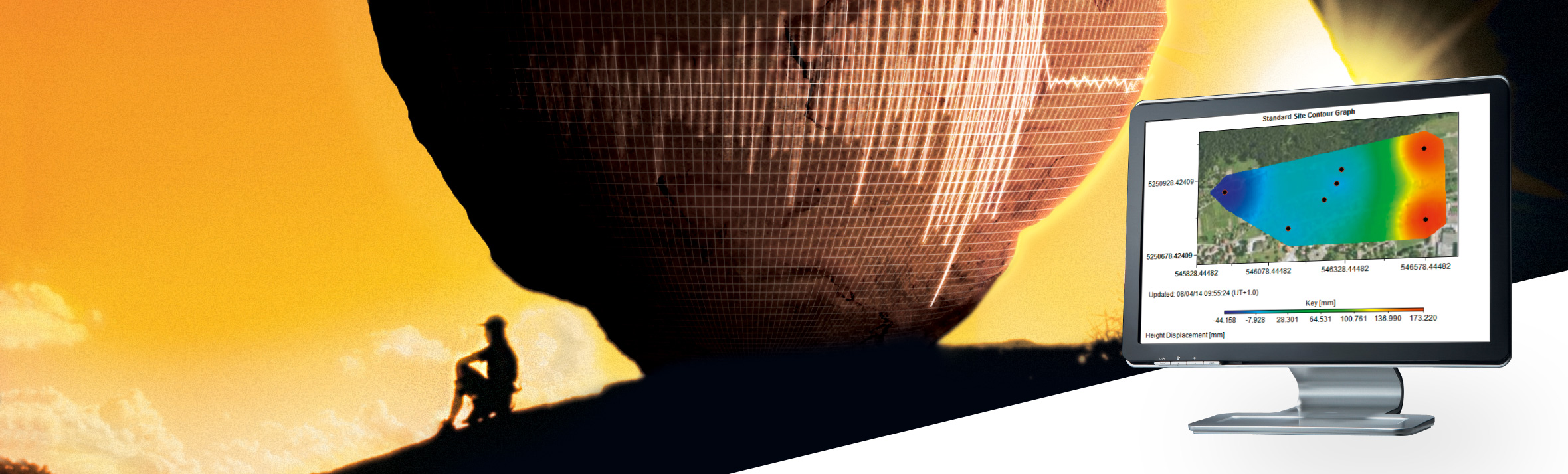
Receive accurate and timely information on project status using a series of maps, charts, images, tables, automatic reports, and scans. Integrate geodetic and geotechnical measurements with GIS shape files and raster data. GeoMoS Now! supports georeferenced data formats, allowing users to have customized views with layers of additional data sets. Users can also add custom views overlaid with data for interpretation.
Ideal for surveyors and engineering companies, Leica GeoMoS Now! Survey Edition offers a simple and easy solution for managing measurements in campaigns. GeoMoS Now! Survey Edition restructures monitoring campaign workflows using the cloud to easily upload coordinates, process and visualize deformation results, and access any existing surveying project.
Share results with experts or project managers in real-time using any web device. All it takes is a simple file import into GeoMoS Now! to start managing monitoring campaign data and benefit from GeoMoS Now! functionalities.
It is the fastest and most efficient solution on the market, allowing all digital level and total station operators to collect, process, and distribute monitoring information.


