

The Leica automatic deformation monitoring system. Flexible automatic auscultation software solution.
Leica GeoMos is a real-time structure monitoring and analysis solution. It allows visualization of geospatial data in 2D and 3D, and offers customized alerts for risk prevention.
The Leica automatic deformation monitoring system. Flexible automatic auscultation software solution.
Leica GeoMos is a real-time structure monitoring and analysis solution. It allows visualization of geospatial data in 2D and 3D, and offers customized alerts for risk prevention.
For monitoring professionals who need to understand and quickly react to the complex demands of current monitoring projects, Leica GeoMoS is a solution that provides the necessary flexibility to your projects. With scalable software, options, and various license packages, the Leica GeoMoS family adapts to the specific needs of any user. Suitable for continuous or periodic projects, a complete monitoring solution is offered with maximum precision and reliability.
With over 20 years of monitoring experience and the support of a team of highly experienced engineers, Leica GeoMoS is a vital partner in a wide range of monitoring challenges.
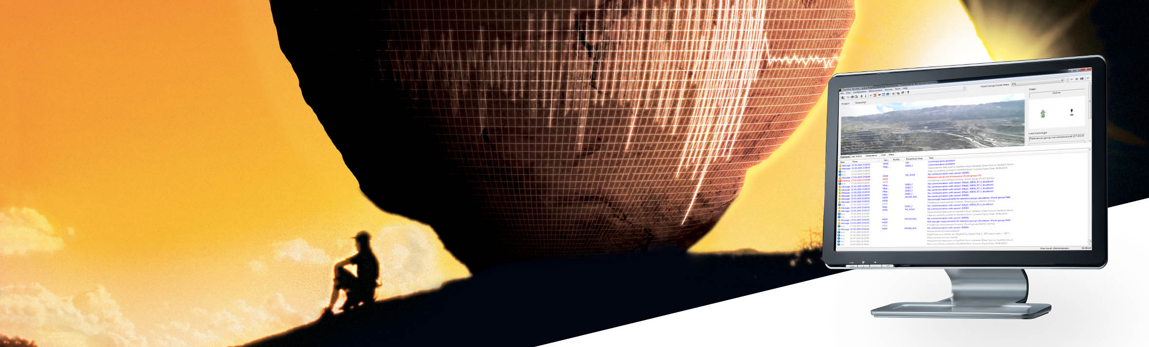
Leica GeoMoS supports connection with any sensor or monitoring software, whether from Leica Geosystems or third parties. Flexible communication options allow seamless connection, sensor control, and instant data storage and analysis. The Leica GeoMoS API allows combining GeoMoS data into your own system. Automated data flows using numerous open interface standards enable simple yet powerful sensor fusion. GeoMoS Monitor ensures a 24-hour measurement cycle with sensor scheduling and can store all important data in a single SQL database.
The acquisition of geodetic, geotechnical, environmental, or any other type of sensor data is guaranteed accurately and reliably through outlier detection, data validation, filtering, and automatic re-measurement. If system status and critical observation limit checks are active, responsible parties are promptly informed via various messaging options (email, SMS, alert). Advanced mathematical calculation and the combination of observations from different sensors ensure the most precise stability of your monitoring.
Leica GeoMoS Imaging is an imaging extension of the existing GeoMoS solution. It is a monitoring technology that provides image-based information for documentation, inspection, and detection from remote access. Live visualization with joystick functionality and continuous visual recording in monitoring projects increase user productivity and provide all the necessary information for quick and easy decision-making.
Powerful, versatile, and highly customizable, the GeoMoS Now! service can be installed locally or used in the cloud, allowing you to access results anytime and anywhere. Receive an accurate and timely overview of project status through a series of easily configurable graphs, images, maps, tables, and deformation scans without needing web design knowledge. Add external links to your project or use the GeoMoS Now! API to securely include project images on any web page. Assign multiple viewers to a single project and distribute custom reports to any number of users.


