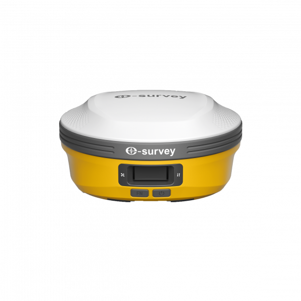

The eSurvey eRTK60 is a next-generation visual GNSS receiver that combines GNSS, IMU, and dual-camera technologies to deliver more precise, flexible, and efficient measurements. Thanks to its visual measurement technology, you can obtain accurate coordinates of hard-to-reach or signal-blocked points without physically accessing the target.
The eSurvey eRTK60 is a next-generation visual GNSS receiver that combines GNSS, IMU, and dual-camera technologies to deliver more precise, flexible, and efficient measurements. Thanks to its visual measurement technology, you can obtain accurate coordinates of hard-to-reach or signal-blocked points without physically accessing the target.
The eRTK60 introduces a new era in GNSS surveying with its integrated visual system, long-range UHF radio, and dual hot-swappable batteries. Designed to maximize field productivity, it offers the perfect balance between power, endurance, and ease of use.
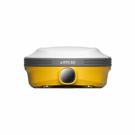
The Visual Survey technology of the eRTK60 provides accurate coordinates from images captured in seconds. Measure what you see—no need to physically reach the point. Perfect for inaccessible, hazardous, or GNSS-blocked areas.
CAD drawings are displayed directly on the screen environment. This augmented reality stakeout feature simplifies complex construction tasks and speeds up the staking process, reducing errors and improving productivity.
With its dual hot-swappable battery system, the eRTK60 eliminates charging downtime. Its symmetrical design allows one battery to be replaced while the other continues operating, keeping you productive all day long.
The 1.1” color LED display shows essential receiver information such as status, working mode, connectivity, and power. It allows fast and visual configuration and operation without external controllers.
The integrated UHF modem is compatible with major radio protocols (TrimTalk, Satel, South, Geotalk, Hi-Target, among others). With 1W/2W transmission power, it reaches distances up to 15 km under optimal conditions.
| Constellations | GPS, GLONASS, Galileo, BeiDou, QZSS, SBAS, NavIC |
|---|---|
| IMU Tilt | Up to 60° dynamic compensation |
| Cameras | Dual – 2 MP (Visual Survey and Visual Stakeout) |
| UHF Frequency | 410 – 470 MHz |
| Radio Protocols | TrimTalk, Satel, Geotalk, Hi-Target, South, HZSZ, PCC, FARLINK |
| Max Communication Distance | Up to 15 km (1W / 2W TX) |
| Internal Memory | 8 GB |
| Batteries | 2x Li-ion 7.2V / 3400 mAh (hot-swappable) |
| Operating Time | Up to 10 hours as UHF base |
| Display | 1.1” color LED |
| Weight | 931 g |
| Dimensions | Φ156 × 74.5 mm |
| Durability | IP67, 2 m drop-resistant, 100% vibration-proof |
| Operating Temperature | -30 °C to +65 °C |
| Connectivity | Bluetooth 5.0 EDR & BLE, Wi-Fi 2.4G/5G, Global 4G LTE, USB-C |
| Operating System | Linux |
| Software Compatibility | SurPad, NMEA, RTCM, RINEX |
Thanks to its combination of precision, vision, and durability, the eRTK60 is ideal for:
Global Geosystems is the official distributor of eSurvey in Spain and Portugal. For demonstrations or technical inquiries about the eRTK60, please contact our team.


