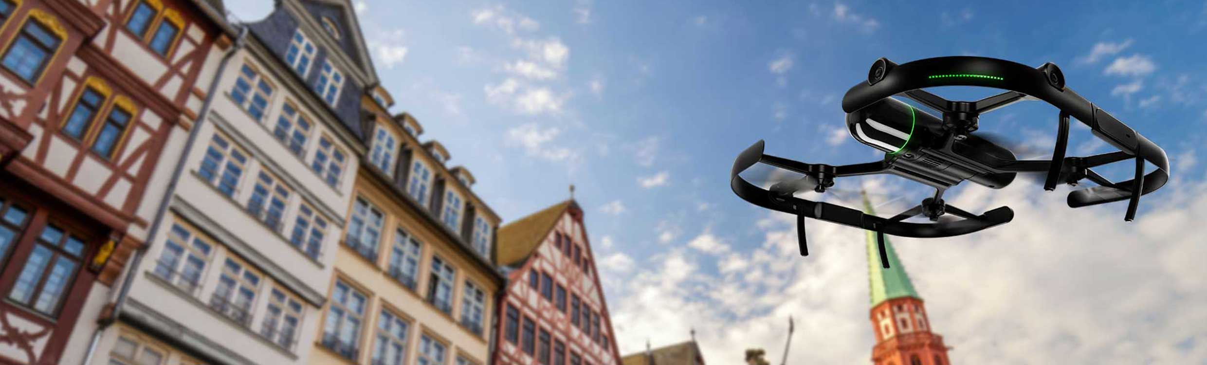
Autonomous Flying Laser Scanner Leica BLK2FLY
The Leica BLK2FLY is an autonomous flying laser scanner with advanced obstacle avoidance to easily capture reality from the sky. It captures the exteriors of buildings, structures, and environments to create 3D point clouds while flying. The BLK2FLY is designed to be user-friendly: with just a few taps on a tablet, users can get the BLK2FLY airborne to autonomously scan the exteriors of buildings and their features, including hard-to-reach areas like roofs and facades. Deploying the device is as easy as unfolding it, turning it on by pressing a button, and placing it on the ground, ready for takeoff.
<img src="https://
Consulta nuestras condiciones de financiación.
The Leica BLK2FLY is an autonomous flying laser scanner with advanced obstacle avoidance to facilitate capturing reality from the sky. It captures exteriors of buildings, structures, and environments to create 3D point clouds while flying. The BLK2FLY is designed to be easy to use: with a few simple taps on a tablet, users can get the BLK2FLY airborne to autonomously scan the exteriors of buildings and their features, including hard-to-reach areas like roofs and facades. Deploying the device is as easy as unfolding it, turning it on by pressing a button, and placing it on the ground, ready for takeoff.
Users control the BLK2FLY via the BLK2FLY Live app on a tablet for simplified, app-based flying without any prior UAV experience. This allows easy and intuitive control of the BLK2FLY, including live camera feed. You can select an area within the map on your tablet, and the BLK2FLY will create its own flight path to scan it quickly and safely. You can also tap to scan: simply send the BLK2FLY to scan a new area by tapping anywhere on the 3D view in the app.
The BLK2FLY Live app also allows you to manually pilot the BLK2FLY with virtual joysticks on your tablet. This critical safety feature keeps you always in control. And for connectivity, the BLK2FLY includes WLAN and LTE communication channels to the tablet for almost unlimited communication range during flight.
The BLK2FLY makes it easy to bring your data into your preferred software and share your scans with others. It also works seamlessly with other sensors and software from Leica Geosystems. You can directly upload your data to HxDR with automatic conversion to OBJ and cloud-based visualization, and also allow others to access and work with your data, including downloading data, through HxDR. Or transfer your data to Leica Cyclone REGISTER 360 via USB-C or WLAN for scanning to BIM workflows.
You might also like