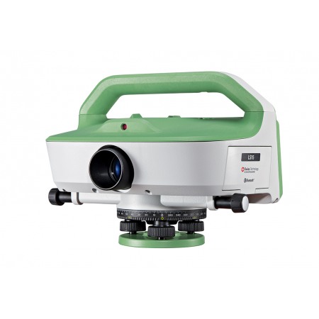
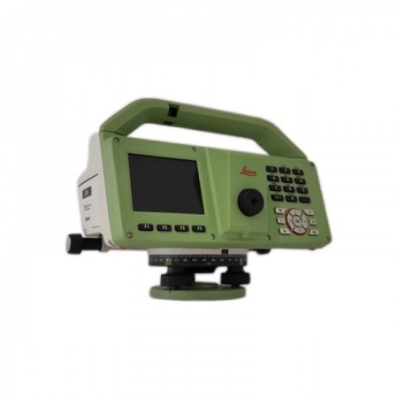
The Leica LS15 and Leica LS10 digital levels improve demanding leveling tasks from any location. Their automatic functions and market-leading 0.2 mm precision allow users to easily demonstrate their measurement skills while effectively carrying out any project.
The Leica LS15 and Leica LS10 digital levels improve demanding leveling tasks from any location. Their automatic functions and market-leading 0.2 mm precision allow users to easily demonstrate their measurement skills while effectively carrying out any project.
Consulta nuestras condiciones de financiación.
From autofocus to touch screen, with its clear displays: the entire measurement process gains efficiency with the LS15 and LS10 digital levels. Common leveling errors, such as errors in reading the staff, are a thing of the past. Our leveling solutions offer the most reliable and understandable results, starting from workflows with color images, making the daily tasks of professionals more enjoyable.
Users benefit from Leica Geosystems' experience as the creator and market leader of digital levels. These solutions, which refine the digital level to make it a kind of art, record the results more quickly and with the highest possible accuracy.
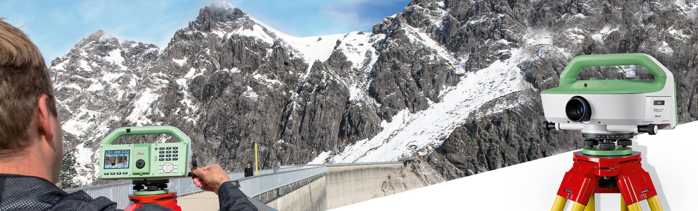
The experience with Leica Geosystems LS digital levels doesn't end in the field. After transferring your data to the office in the simplest way, Leica Infinity processes your results seamlessly. This intuitive software presents complex leveling data in an understandable way.
Through Active Customer Care, you can access with just one click a global network of qualified professionals who will guide you to solve any problem:
Control your expenses with a personalized Customer Care Package, which will give you the peace of mind of being covered everywhere and at all times.
You might also like