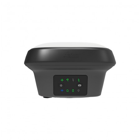
A smart GNSS antenna that grows with your business. Versatile, high-quality RTK surveying equipment.
The Leica GS18 is a high-precision GNSS (Global Navigation Satellite System) equipment designed for field surveying measurements. With its advanced satellite tracking technology, the GS18 provides accurate and reliable measurements even in challenging conditions.
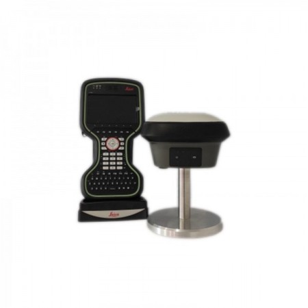
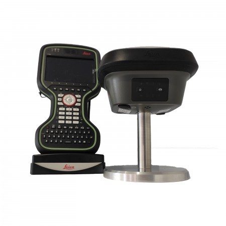
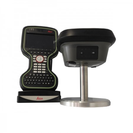
Its ergonomic and lightweight design makes it easy to transport and handle during long days of fieldwork. Furthermore, its compatibility with the Leica Captivate software platform makes it easy to integrate with other surveying instruments and transfer data for further processing.
A smart GNSS antenna that grows with your business. Versatile, high-quality RTK surveying equipment.
The Leica GS18 is a high-precision GNSS (Global Navigation Satellite System) equipment designed for field surveying measurements. With its advanced satellite tracking technology, the GS18 provides accurate and reliable measurements even in challenging conditions.
Its ergonomic and lightweight design makes it easy to transport and handle during long days of fieldwork. Furthermore, its compatibility with the Leica Captivate software platform makes it easy to integrate with other surveying instruments and transfer data for further processing.
Consulta nuestras condiciones de financiación. / Consult our financing conditions.
The Leica GS18 is a smart GNSS antenna with self-learning capability. The GS18 inherits all the functions of the Leica GS18 T, except for the tilt compensation. However, the GS18 grows with your business: you can upgrade it to a system with tilt compensation at any time.
The GS18 is an excellent companion for a surveyor working mainly with an RTK network, such as HxGN SmartNet. Like most Leica Geosystems smart GNSS antennas, the GS18 can be used as both rover and base.

UPGRADE TO TILT-COMPENSATED EQUIPMENTWhenever you need the efficiency and safety improvements gained from tilted measurements, you can upgrade your GS18 to a rover with tilt compensation. Any Leica Geosystems service can perform the upgrade at any time. |
ATTRACTIVE SOFTWAREThe Leica Captivate field software is the perfect companion for the GS18. With user-friendly applications, you can view and use all measured and design data, providing you with a clear understanding of the data in 2D and 3D views. Captivate spans industries and applications with little more than a simple touch, whether you are working with GNSS, total stations, or both. |
PERFORMANCE ENHANCEMENTThe multipath reduction and interference mitigation options in Captivate enhance the quality of GNSS signal tracking in challenging environments, improving RTK availability and accuracy. Also, an interference filtering toolkit allows you to remove distortions within and outside the frequency band for even more robust GNSS signal tracking. |
4G LTE & EXCELLENT MEASUREMENT QUALITYMulti-frequency signal tracking comes standard with all Leica Geosystems GS receivers. Combined with an excellent GNSS antenna and a 20Hz position update rate, the GS18 ensures tremendously reliable measurement quality. |
INTERNAL MEMORYUsers with any GS18 model have the flexibility to record raw data to an SD card or internal memory. |
ACTIVE CUSTOMER CAREThrough Active Customer Care (ACC), a global network of experienced professionals is just a click away to guide you through any challenge. Control your costs with a Customer Care Package (CCP) that gives you the peace of mind of being covered anytime, anywhere. |
| LEICA GS18 T | LEICA GS18 I |
You might also like